Flying to Niihau
The trip to Niihau was the highlight of our vacation. Not only was it a difficult place to reach, but it was the first time I've ridden in a helicopter.
Niihau is a 69.5 square mile island 17.5 miles southwest of Kauai. It has 130 permanent inhabitants. We approached it via its eastern cliffs and traveled clockwise around the island. We landed on a secluded beach on the northwestern tip, across from Lehua Island (that U-shaped islet on the map below).
The only way visitors can reach the private island is via Niihau Helicopter. The island's owners, the Robinson brothers, bought a helicopter for medical evacuations. It offers tours to defray costs. On average, it flies tourists there (5 to 7 tourists per trip) two to three times a week (so about 750 tourists a year). But since medical flights, military use (for a radar station on the island), and residential use take precedence, getting bumped is the rule rather than the exception.
The helicopter office is in an anonymous building just west of Port Allen on the south side of Kauai.
After getting weighed in (the Agusta 109A maxes out at 1,100 pounds), we drive to Port Allen airport.
I got to sit in the front, which was really cool.
Over the channel, we flew between 2,000 and 3,000 feet at a maximum of 180 knots. The wheeled Agusta is the fastest civilian helicopter in the state.
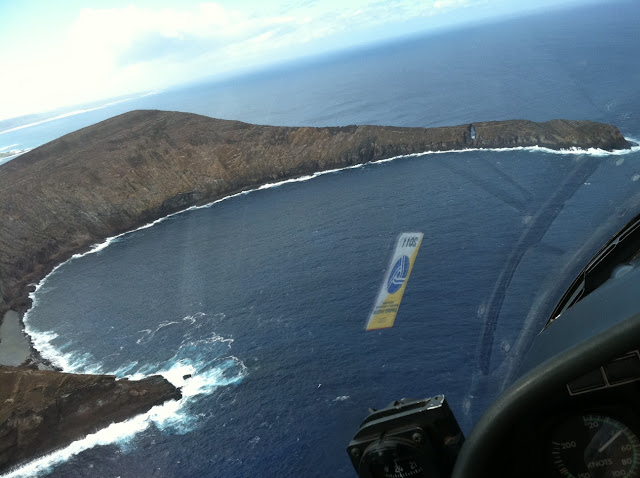
Here is the approach from the east. Lehua is on the right. If you look closely, you can see that Niihau almost touches Lehua. From afar, you'd think that Niihau only consisted of the cliffs, but there is also a significant, low, flat area between Lehua and the Niihau cliffs.
A view from the side window. A/C is too heavy (600 pounds) for the helicopter, so we stuck our hand out the window to let fresh air in.
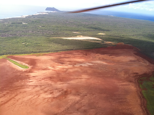
Niihau, a very arid place, has the largest lakes in the state.
Dry lake bed.
This is us skirting the western shore, heading north. Lehua is in the background.
This is a view down. I was terrified that my rental car key was going to fall through the opening. This shot is very Magnum, P.I.
A few monk seals dotted the beaches. I'll post a picture of one we saw on the beach tomorrow.
There are signs of life. Dirt trails. The settlement of Pu'uwai, where all the residents live. And quite a few Korean War era army trucks, which are used as transportation. They look very post-apocalyptic. To protect their privacy, we did not take any pictures of the town or the residents. Trust me, I really wanted to take pictures of the trucks to share with you all, but there was almost always a resident or two in or next to the vehicles.
There is a herd of elands, introduced from Molokai Ranch.
Our shadow along a dirt trail.
The leeward beaches are pristine. The windward beaches, not so much (more on that later).
Lehua is in the foreground and Niihau is in the background. After we landed on Niihau, we first hung out at the beach to the left, and then we moved to the beach on the right.
Here is us landing. You can barely make out one of the old cars in this picture.
Subscribe to:
Post Comments (Atom)


0 comments:
Post a Comment